| Municipal Maps |
|
Zoning - This map was created using a combination of King County GIS parcel and street data
as well as AutoCAD drawing files. Aerial photography, supplied by the City of Bellevue IT Department, helped
update building footprints and other planimetric information. Data will provide a basis for a future impervious
surface rate study. [Note: This map is an official zoning map for the City of Clyde Hill]
|
|
PDF File

4,826 kb
|
|
|
Zoning - This map was created using a combination of King County GIS parcel and street data
as well as AutoCAD drawing files. Aerial photography, supplied by the City of Bellevue IT Department, helped
update lake shore lines and other planimetric information. [Note: This map is an official zoning map for the Town of Hunts Point]
|
|
PDF File
4,826 kb
|
|
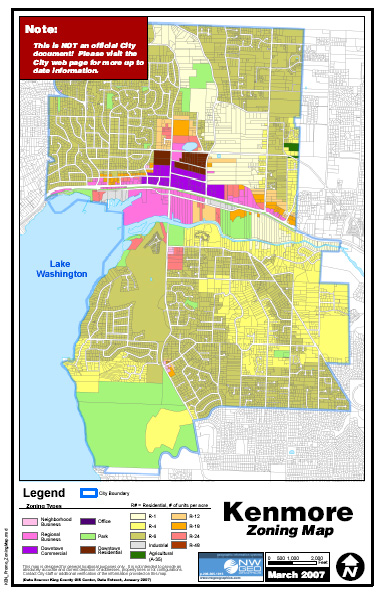
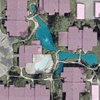
| Zoning - This map is a promotional map, made for the City of Kenmore [WA]. Source
materials came from the King County GIS data DVD.
|
|
PDF File
960 kb
|
|
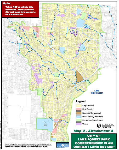
| Land Use - This map is a promotional map, made for the City of Lake Forest
Park [WA], as an example of supporting map graphics for comprehensive plans. Source materials came from
the King County GIS data DVD.
|
|
PDF File
1,608 kb
|
|
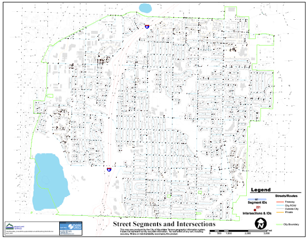
| Street and Intersections - This map, made for the City of Mountlake
Terrace [WA], allowed City staff to begin analyzing various transportation routes within the city. Future
uses include attaching accident and traffic counting data to existing interesection graphics as well as
associating pavement management records to individual street segments.
|
|
PDF File
5,384 kb
|
|
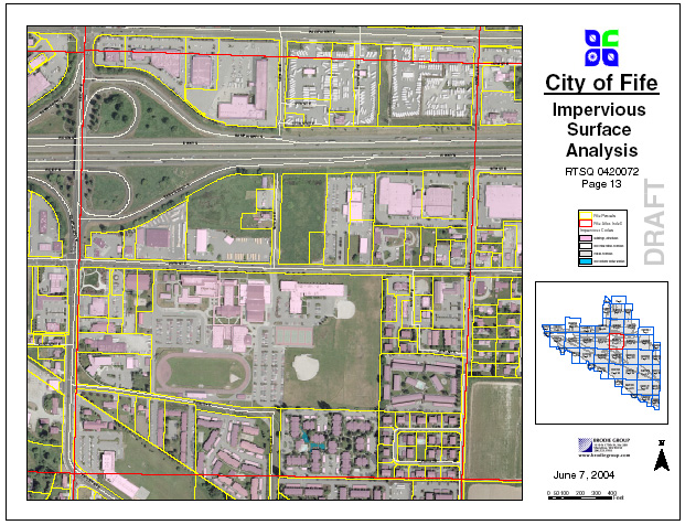
| Impervious Surfaces - This map is a sample in a series of 34 E-sized PDF files created for the City
of Fife [WA]. Using Pierce County parcel lines and digital imagery, various surfaces were captured and
coded for the eventual creation of a storm water utility. Note this document was scaled down for web
display from an original PDF size of 22 MB.
|
|
JPG File

4,663 kb
|
| Public Safety |
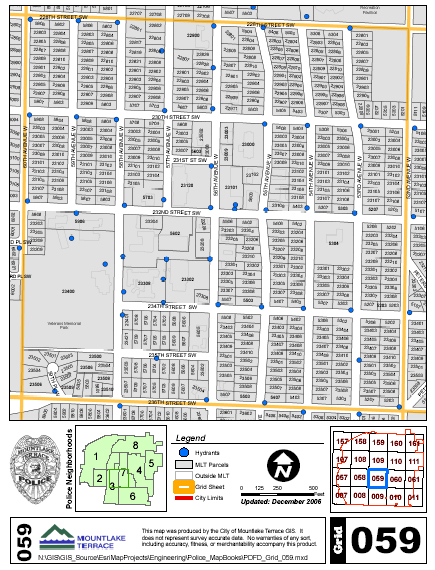
| Grid Book - This is one of 25 notebook-sized grid maps that were created
for the City of Mountlake Terrace [WA] Police and Fire Department. They depict street addresses as well as the
locations of fire hydrants.
|
|
PDF File
506 kb
|